European Union uses unrealistic map of Aegean Sea, Cyprus island
 Turkish coast guard forces in Izmir, Türkiye (AA File Photo)
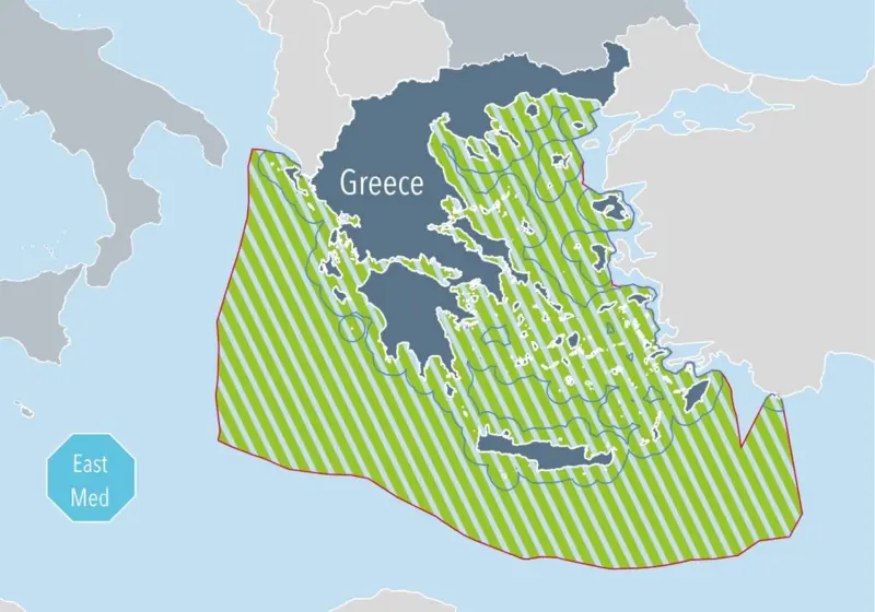
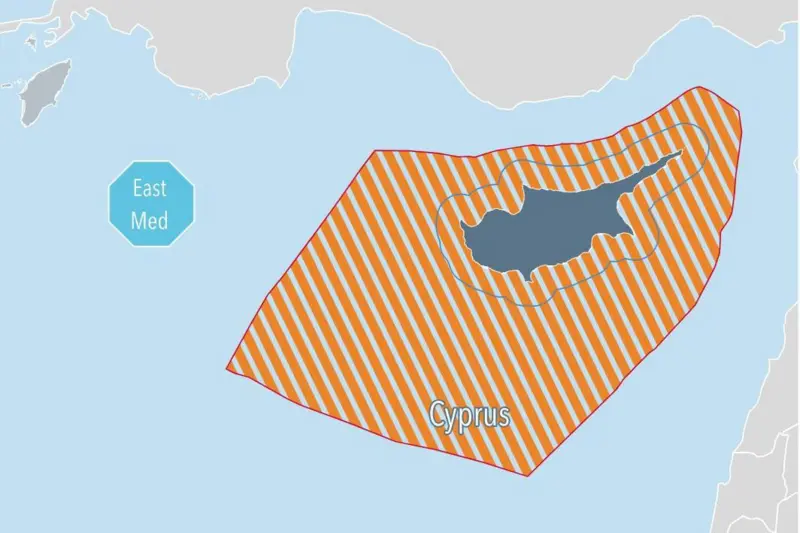
The European Union’s maps of the Aegean Sea and Cyprus island published on its official website as part of the European Commission’s Spatial Maritime Planning studies stirred strong reactions from Ankara and the Turkish public.
“At the heart of Türkiye’s discomfort is the argument that the EU does not have jurisdiction over maritime jurisdiction areas and that it is not right for it to express an opinion,” BBC Turkish wrote.
Maps under scrutiny
Türkiye and Greece do not have a clear maritime boundary agreement. The status quo at the moment is at 6 nautical miles (nm) in the Aegean Sea. Athens attempted on several occasions to change its territorial waters to 12 nm.
The EU’s maps depicted Greece’s territorial waters as 12 nm and the map on Cyprus island completely ignored the existence of the Turkish Republic of Northern Cyprus.


Such a 12-nm move would increase Greek territorial waters in the Aegean Sea from 40% to 70%. Ankara previously communicated that changing territorial waters from 6 to 12 nm would be a casus belli scenario.
Despite disputes and no clear agreement on the matter, Türkiye and Greece are approaching the matter through diplomacy. A diplomatic solution and lasting agreement are necessary to sort out several tense bilateral issues.
In the lead-up to such an agreement, senior diplomats continue meetings with the next one scheduled to be in Athens on Dec. 2-3.
President Recep Tayyip Erdogan will host Greek Prime Minister Kyriakos Mitsotakis in early 2025.
The meetings are held under the bilateral High-Level Cooperation Council (HLCC), proposed by Turkish diplomats and ongoing since 2010.


