What lies beneath Türkiye? New findings reveal tectonic shifts under our feet
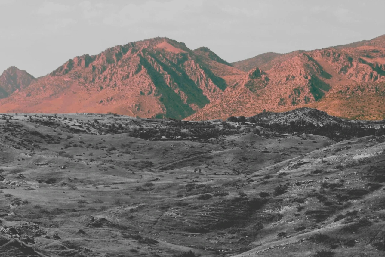
 "The Zagros Mountains and the sediments that have accumulated over millions of years along the depression at the base of the mountains. (Photo by Renas I. Koshnaw)
An international research team, led by the University of Gottingen, has uncovered significant new insights into the forces shaping the Earth’s surface beneath Türkiye.
The study, published in the journal Solid Earth, highlights the ongoing process of a deep tectonic shift occurring in the northern region of Iraq, revealing how the forces from the Zagros Mountains have contributed to the bending of the Earth’s surface over the past 20 million years.
Tectonic plate breaks underneath Earth’s surface
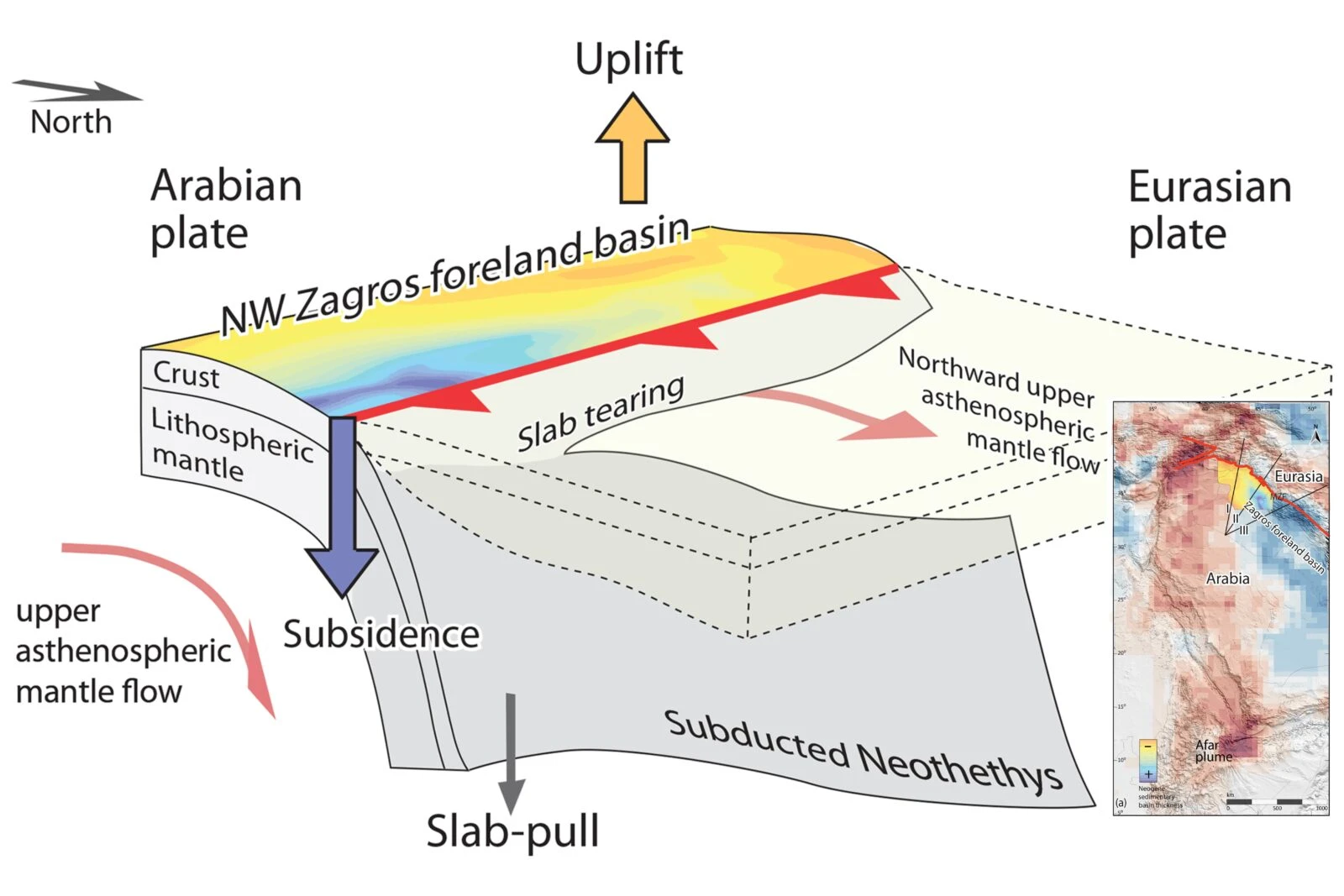
The team’s findings show that the Neotethys oceanic plate—the once vast ocean floor that separated the Arabian and Eurasian continents—has been breaking off horizontally beneath the Earth’s surface.
This tear has progressively extended from southeastern Türkiye to northwestern Iran, indicating a crucial tectonic process occurring deep below the Earth’s crust.

Impact of colliding continents on Earth’s surface
Over millions of years, when two continents converge, the oceanic floor between them sinks to great depths, ultimately forming towering mountain ranges as the continents collide. As these mountains form, the weight causes the Earth’s surface to bend downward. This creates large depressions that, over time, accumulate sediments from the eroded mountains. Such depressions have formed plains like Mesopotamia in the Middle East.
The research team used a geophysical model to simulate the downward bend of the Earth’s surface caused by the colliding Arabian and Eurasian continents. They calculated the depression formed by the weight of the Zagros Mountains and compared it with the Earth’s mantle topography to recreate the unusually deep depression in the southeastern part of the study area.
New discovery: Role of sinking oceanic plate
While the weight of the Zagros Mountains alone explained much of the depression, the researchers found an even deeper 3-4 kilometers depression than expected. This could not be attributed solely to the mountains.
Renas Koshnaw, lead author and Postdoctoral Researcher at Gottingen University’s Department of Structural Geology and Geothermics, proposed that this anomaly is due to the oceanic plate, still attached to the Arabian plate, pulling the region downward from below.
Koshnaw explained: “The sinking plate is creating space for additional sediment accumulation, making the depression much deeper than it would otherwise be.”
The study revealed that in the area closer to Türkiye, the depression becomes shallower, which suggests that the oceanic plate has broken off in this region, relieving some of the downward pull.


